Sunday, December 11, 2016

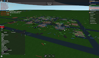
Elwood 12/10/2016 EF-5

General Information:

This tornado is the final tornado in the Elwood-Greenfield outbreak, bringing the outbreak to a close with 1 EF-5, 1 EF-3, and 4 EF-0 tornadoes. Taking into account only windspeeds, then the tornadoes to occur in this outbreak were (in order) EF-3, EF-1, EF-2, EF-1, EF-2, EF-5. This tornado tore through the southwestern flank of Elwood, leaving only a few houses at the northeast end still standing. The tornado's unusual southeast movement proved deadly to a couple chasers, tossing chaser cars (and citizen cars) as far as Greenfield's outer limits.

Statistics:

  • Maximum Windspeed: 218 MPH
  • Cities Impacted: Elwood
  • Time on Ground: c. 40 minutes
  • Damage Rating: 216 MPH Mid EF-5

Damage Survey:

My damage survey (enlarged to compensate for darkness)
 

Saturday, December 10, 2016

Elwood-Greenfield Monster EF-3

General Information:

This tornado formed over Elwood, essentially arcing around the edge of the city for the beginning of its lifespan, before strengthening and punching through the core of the city. Just before exiting the city of Elwood, the tornado hit its maximum windspeed of 151 MPH, tearing apart the final house before weakening as it meandered across the field. The tornado managed to reach Greenfield as a measly EF-1, before finally dissipating altogether.
This tornado is the first tornado in the 12/10/2016 Elwood-Greenfield outbreak. Of the six tornadoes in this outbreak, this tornado is only one of two to damage the city, the other a monster EF-5.

Statistics:

  • Max windspeed: 151 MPH
  • Cities Impacted: Elwood, Greenfield
  • Time on Ground: c. 30 minutes
  • Damage Rating: 150 MPH Mid EF-3

Images:

Elwood damage (with survey)

Greenfield damage (with survey)

Greenfield Damage (no survey)

Elwood damage (no survey)
 

Friday, November 25, 2016

Quick EF-5 update

Dislodged slab in Greenfield, ranking this tornado as a weak EF-5.
Barely moved slab in Elwood

Dislodged slab in Elwood
Since I don't have time, this will be just a quick summary.
  • Max Windspeed: 280 MPH
  • Max Damage Speed: 200 MPH Weak EF-5
  • Cities Affected: Greenfield and Elwood
  • Time on Ground: No Idea whoops LOL

Wednesday, October 5, 2016

Lack of Damage Surveys

Just wanted to explain myself a bit as to why there were no damage surveys present for almost two straight months.

I've been very busy. Plain and simple.

On average, I have about thirty minutes of time to myself and I'd much rather be using that time to gather my thoughts and do my own personal things than do a damage survey every day. There will be more damage surveys in the future, but the frequency will likely be very small.

Friday, August 12, 2016

8/11/2016 Greenfield EF-3

General Information:

This tornado touched down south of Greenfield, quickly gaining size and strength. The tornado hit its maximum windspeeds of c. 170 MPH outside the city, then began weakening just as it entered the city. As it demolishes homes and the HQ, the tornado continues to weaken, eventually exiting Greenfield and dissipating altogether.

Statistics:

  • Max windspeed: c. 170 MPH
  • Cities Impacted: Greenfield
  • Time on Ground: Estimated 25-35 minutes
  • Damage Rating: 165 MPH Strong EF-3

Damage Survey:

Image taken thirty-six minutes after the tornado dissipated.


Monday, July 25, 2016

7/25/2016 Greenfield - Elwood EF5

General Information:

This tornado touched down just outside of Trenton, moving very slowly at first. The tornado quickly gained strength and moved Northwest towards Greenfield, where it would hit 200 MPH winds just inside the city. The tornado moves through Greenfield, completely leveling many homes, the storm chaser HQ, and knocking down the tower. The tornado continues gaining strength even as it moves out of Greenfield, reaching 278 MPH, then weakening as it continues towards Elwood. The tornado hits Elwood, moving a slab, then continues to weaken as it moves throughout the city. After the tornado exits Elwood, it continues to an empty field where it dissipates. Left in its path is total destruction.

Statistics:

  • Max Windspeed: 278 MPH
  • Cities Impacted: Greenfield, Elwood
  • Time On Ground: c. 50 minutes
  • Damage Rating: 200-215 MPH Weak EF-5*
*This damage rating is not exact because there is no current estimate for storm shelter destruction. In fact, in the Greenfield survey image, I forgot to point out the destroyed storm shelter as it was covered by part of a house's roof.

Damage Survey:

 
Greenfield Damage Survey (there should be one more piece of EF-5 damage where the storm shelter is)

Elwood Damage Survey
This tornado is the second EF-5 to impact two cities. However, it is the first undisputed EF-5 to impact two cities.

Sunday, July 24, 2016

7/24/2016 Trenton Outbreak

Outbreak Statistics:

  • Number of Tornadoes: Three
  • Maximum Rating: 210 MPH Weak EF-5
  • Minimum Rating: 65 MPH Weak EF-0*
 *This tornado is rated the minimum possible rating as it did not hit any structures, rather, formed near the city of Trenton

Tornado 1 Statistics:

  • Max Windspeed: c. 300 MPH  
  • Cities Impacted: Trenton
  • Time On Ground: c. 65 minutes
  • Damage Rating:   210 MPH Weak EF-5
Damage Survey:
 

 Tornado 2 Statistics:

  • Max Windspeed: c. 200 MPH
  • Cities Impacted: None**
  • Time On Ground: Unkown
  • Damage Rating: 65 MPH Weak EF-0
**This tornado formed just outside of Trenton, but did not impact the city.

Tornado 3 Statistics:

  • Max windspeed: c. 110 MPH
  • Cities Impacted: Trenton
  • Time On Ground: 8 minutes
  • Damage Rating: 109 MPH Strong EF-1
Damage Survey:
    

Thursday, July 21, 2016

7/21/2016 Newton EF-4

General Information:

This tornado occurred on July 21, 2016 at around 2:15 P.M. Eastern. The tornado formed in the field between Elwood and Newton, quickly gaining size and strength. As it moved towards Newton, it turned towards the heart of the city as it was still strengthening. As it moved throughout Newton, it gained strength, and peaked at 166 MPH just as it exited the town. The tornado moved towards the empty fields and died out before hitting any other cities. As a result of the tornado, many houses were leveled, and a police car was thrown from the station into another house (which was freed before the image was taken). After this tornado, another 153 MPH tornado would touch down outside of Newton, hitting no structures and earning an EF-0 rating.

Statistics:

Max Windspeed: 166 MPH
Cities Impacted: Newton
Time On Ground: Unknown (No witnesses kept track)
Damage Rating: 153 MPH Strong EF-3
Photo of the damage twenty minutes after the tornado lifted.
 
My personal damage survey.

Other Damage Surveys:

  • 153 MPH Strong EF-3 (mine)
  • 166 MPH Weak EF-4 (Trevanothebest)
  • 152 MPH Mid EF-3 (on-site witness)

Tuesday, July 5, 2016

7/5/2016 Dover Outbreak and Damage Survey

General Information:

This outbreak occurred on July 5, 2016 starting at approximately 2:15 P.M. EDT and ended approximately 3:30 P.M. EDT. During this time, five storms spawned and three tornadoes touched down. Two of these tornadoes were ranked EF-0 as they did not hit any structures, though one hit speeds of 165+ MPH. Below is my damage survey of the third tornado, whose winds peaked at 183 MPH and destroyed the city of Dover.

Statistics of Tornado:

Max Windspeed: 183 MPH
Cities Impacted: Dover
Time On Ground: ~40 minutes
Damage Rating: 148 MPH Mid EF-3
Overhead view of Dover moments after the tornado.
My personal damage survey moments after the tornado.

Random Facts and Other Important Information:

  • This tornado is the strongest to ever hit Dover both in damage speed and wind speed.
  • Out of the four damage survey personnel present, the ratings went like this:
    • Mid EF-3 (mine)
    • High EF-3 (zachthetwister)
    • High EF-3 (on-site witness)
    • Weak EF-3 (on-site witness)
  • Along with this thunderstorm complex/tornado outbreak, an amazing spectacle of lightning was shown
  • This is one of the first non-EF-5 tornadoes to have more than two people give a damage survey

Friday, July 1, 2016

7/1/2016 Greenfield EF-5

Statistics:

Max Windspeed: 273 MPH
Cities Impacted: Greenfield
Time On Ground: ~50 to 65 minutes
Damage Rating: Weak EF-5
This tornado formed in the open desert, where it remained for much of its long lifespan. Shortly after the tornado peaked at 273 MPH, the tornado began moving towards Auburn. After it began weakening, it quickly changed course to Greenfield. The tornado reached Greenfield when it had winds of approximately 230 MPH. The tornado continued through the heart of Greenfield, continuing to weaken. The tornado fell below 200 MPH just past HQ, then continued out of the city. Only one house survived the tornado. Shortly after this tornado, tornadoes with both EF-4 and EF-3 wind speeds occurred just outside Trenton.

Random facts because I FEEL LIKE IT:

  • This tornado is the first EF-5 tornado (on this blog at least) to peak outside of a city
  • A TIV 2 was thrown from one impacted house to the only non-impacted house, left surprisingly undamaged.
  • This tornado is one of the only tornadoes to have taken down both the siren and camera tower
  • I don't know what else to put here. What do you wish to know? :3

Images:

Overhead view of Greenfield following the tornado (sorry about the darkness)
Storm shelter entrance completely blocked and destroyed
HQ completely leveled, entrance almost blocked
My damage survey

There is an asterisk (*) next to a house that says Weak EF-5. This is because I gave this one specific house an EF-5 rating because I saw that the slab was very slightly rotated. However, one damage survey personnel did not think the slab was rotated enough to be considered true EF-5 damage. Since there were other, more clear evidences of EF-5 damage present in their survey (which was more of a verbal agreement so I knew what to put on the EF-5 list), their rating still stood as EF-5.

7/1/2016 Dover Tornado

Statistics:

Max Wind Speed: Unknown
Cities Impacted: Dover
Time On Ground: Unknown
Damage Rating: Strong EF-2
Not much is known about this tornado, other than it passed directly through the town of Dover. The tornado impacted all mobile homes, completely destroying several. From my perspective, the tornado looked to be heading west (which looks north in the picture), but I am not sure.
Photo of the damage (excuse the slight language in chat)
 
My damage survey

Wednesday, June 15, 2016

6/15/2016 Twister County Damage Survey (Non EF-5 Example)

Statistics:

Max Wind Speed: 156 MPH
Cities Impacted: Elwood
Time On Ground: Approximately 10-12 minutes
Damage Rating: Mid EF-3 (See second image)
This tornado started just outside Elwood, looking like it was going to barely graze the outskirts as an EF-0 to early EF-1. However, around the time the tornado hit 100 MPH, the tornado quickly turned towards the southwest side of town. The tornado became an EF-2 as it entered Elwood, then continued onward. Just before the tornado exited the town, it became an EF-3 and continued to grow to 156 MPH. The tornado left the town of Elwood, heading for an open field, where it weakened and eventually dissipated.

Images:


Image of the target area, southwest Elwood.
Sample damage survey image.
Frequently Asked Question: "Why is the house with the clean slab not EF-5 damage?"
Good question! The house with the (nearly) cleaned slab was actually a blue house, which is a very weak house. During my chase of this tornado, I discovered an interesting behavior with the stability of each house. Notice how the green house with EF-3 damage had the same damage as the blue house with EF-2 damage. This is because on the stability scale (which has to be learned in Twister County), EF-3 damage to a green house looks the same as EF-2 damage to a blue house and EF-4 damage to a brown house (though it would have to be a low EF-4 instead of a mid EF-4). Plus, the tornado never hit 200 MPH, therefore no EF-5 damage could have been present.

Using this knowledge of the stability scale and how it works, future damage assessments in Twister County (of mine, at least) are able to be more accurately represented. Eventually, I will create an EF Scale for myself based on Twister County. If the owner asks, I will release it to the public after I am finished, but it will take many tornado chases to gather enough information to create an accurate representation.

Saturday, May 21, 2016

Twister County 5/21/2016 Tornado

Twister County: 5/21/2016

Information and Background:

Earlier in the day, four tornadoes had been on the ground at once but no city was hit and nobody was injured. After an active severe weather day, a supercell spawns near Newton and begins moving due north. At 4:00 P.M, the cell drops a tornado. This tornado started in the city of Newton as a weak EF-0. As the tornado moves north towards Elwood, it begins to gain size and strength. Before reaching Elwood, the tornado make a hard right towards Greenfield, moving southeast, but looks as if it will miss Greenfield entirely. After crossing the highway, the tornado reaches EF-5 strength. Just before passing Greenfield, the tornado banks left and aims for the heart of the city. Many homes and businesses are destroyed, and when the tornado is right above HQ, it reaches its maximum wind speed of 284 MPH. The tornado continues moving northeast before banking left again and weakening. The tornado drops below 200 MPH before leaving Greenfield due to its massive size and slow ground speed. The tornado moves west-northwest towards Elwood, weakening as it continues. Just before the tornado reaches Elwood as a weak EF-0, it begins moving back towards Greenfield but dissipates at 4:50 P.M. Left in its path is total destruction, leaving only two homes standing but damaged and leaving the tornado siren (which is currently indestructible in-game). The

Statistics:

  • MAX WIND SPEED: 284 MPH
  • CITIES IMPACTED: One*
  • TIME ON THE GROUND: 50 minutes
  • DAMAGE RATING: Strong EF-5.

Reasons for Damage Rating:

  • Multiple rotated and dislodged slabs
  • Cars thrown from Greenfield beyond the surrounding cities
  • Storm shelter entrance walls and roof completely gone

Pictures:


Two images showing an overhead view of the target area, Greenfield
Rotated slab in south-central Greenfield
Public Storm Shelter entrance walls and roof completely gone with entrance almost completely blocked off
Very slightly rotated slab in southern Greenfield
HQ completely leveled with entrance to basement easily visible

Sunday, April 17, 2016

April 3rd, 2016 Tornado Simulator 2 Damage Survey

RECORDED WINDSPEED: 287 MPH
DAMAGE RATING GIVEN BY ME: Strong EF-5
REASONS FOR DAMAGE RATING:
  • Weak-frame slabs thrown, showing 200+ MPH damage (with the distance showing winds much stronger than 200)
  • Possible slab movement of the HQ (which shouldn't be possible until 300 MPH but I'll go ahead and give it a 260 MPH rating)
  • Complete destruction of the storm shelter entrance in Rockford
  • Complete leveling of even the strongest houses


Video of part of the tornado's lifespan as seen on my YouTube channel:

Please note these images may not show up in the right order since I uploaded them all at once:
Overview of the damage in Wakefield

A weak-frame house in Rockford with the slab moved from underneath the framing

A weak-frame slab thrown in Wakefield

Massive damage to the Storm HQ with possible slab movement

A slab in the middle of the road

Overview of the damage in Wakefield where a thrown slab is clearly visible

Another shot of the damage in Wakefield showing pieces of debris thrown into the parking area

Overhead view of the damage in Rockford, with a slab thrown a large distance to the left

Shot showing many leveled houses in Rockford, including a weak-frame house with the slab completely missing

View showing Rockford's stronger houses, including part of the city which did not get hit

Picture of debris scattered across the road to the public storm shelter in Rockford

Storm shelter entrance completely missing in Rockford

Wednesday, March 16, 2016

Tornado Simulator 2 March 16th, 2016 Damage Survey

Unfortunately, I do not have a video of the tornado in progress. I do have several pictures I took after the fact that show the damage the tornado caused.
Please note the maximum radar-indicated windspeed of this tornado was 207 MPH.

An image showing a couch thrown into the parking area of HQ as well as a storm chaser vehicle thrown into a home.
Bird's-eye shot of the target area, western Wakefield

Strong EF-3 damage to a house during the tornado's decline

Multiple damaged houses during the tornado's decline

A close shot on one weak-frame house damaged. The slab was actually dislodged to where it would occasionally visually glitch into the ground.

Another close shot of a weak-frame house. The slab was actually moved away from its original position.

A close shot of a medium-frame house hit by the edge of the tornado at peak strength. This slab was also dislodged to the point where it would occasionally visually glitch into the ground.

The next two images are outlines of the approximate damage area of the tornado during its lifetime. Please note, inaccuracies may be present due to the zoom of the image, as well as debris getting thrown out of the original path, making the edge hard to determine.
The tornado begins north of Rockford in an open field, then slowly hooks towards Wakefield while gaining size and strength quickly.
The path becomes very irregular at the end of the tornado's life due to extreme shrinkage and erratic turns caused by the tornado being too close to the edge of the map. NOTE: I forgot to include a line showing when the tornado curved back towards the ocean in the penultimate eastern shift.

Not counting the dislodged slabs, my rating for this tornado would be a strong EF-4.
However, if I count the dislodged slabs (which I need to verify with the creator if they are supposed to dislodge or not), my rating for this tornado would be a weak EF-5.
My rating of this tornado is a weak EF-5 unless the creator finds that weak house slabs are thrown at a speed lower than 200 MPH.

UPDATE: The two "dislodged" slabs are a mistake on my part. The slabs normally glitch into the ground due to how thin they are. HOWEVER, there was still a slab thrown so I am going to leave the rating as a WEAK EF-5 until the creator finds out at what speed slabs are thrown from weak houses.